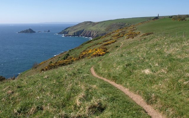
Orcombe Point to Lympstone

About this route

Orcombe Point marks the western gateway of the Jurassic Coast World Heritage Site and its oldest rocks, dating from the early Triassic period around 252 million years ago, can be seen here.

The dramatic red mudstone and sandstone reveal evidence of a previous desert environment  crossed with seasonal life-giving rivers similar to Namibia today. Rare plant fossils have been found here. Of more recent design is the Geoneedle, unveiled by HRH the Prince of Wales in 2002 in celebration of the Jurassic Coast World Heritage Site.

Getting Around

On foot: from Lympstone to Exmouth follow the East Devon Way footpath, and from Exmouth to Orcombe Point the path joins up with the South West Coast Path. Take care whilst exploring the coastline.

By bike: almost entirely traffic free Exe Estuary Trail links Exeter and Exmouth.

By bus and train: frequent local services run from Exeter to Exmouth, visit the Travel Devon website for further information.

By road: From the A376 follow signs to the seafront in Exmouth. For Lympstone there is a car park opposite the Swan Inn within easy walking distance of the pier which is just south of the cliff section.

Facilities
All facilities in Exmouth. Lympstone has refreshments.
Terrain
A mix of footpaths and coastal paths, take care whilst exploring the coastline.
Accessibility

Interesting information

Passing westward from Orcombe Point you come to the Maer Local Nature Reserve. This is an area of sand dunes which, before the construction of the road along the seafront, would have been a landward extension of the bigger dunes on the beach.  This sand rests on a raised beach which is 8 to 10m above the present beach level.

Low cliffs at the northern end of Lympstone show an exposure of a rock consisting of large angular pebbles, made from a variety of rock types including granite, sandstone, and volcanic rocks. This is known as the Exe Breccia (a word that literally means ‘rubble’) and is the result of torrential flash floods bringing material from mountainous ground to the west.

This stretch of coastline also offers terrific views of the Exe Estuary, a site of international importance for its wildlife. It is in an Area of Outstanding Natural Beauty, Site of Special Scientific Interest and World Heritage Site.
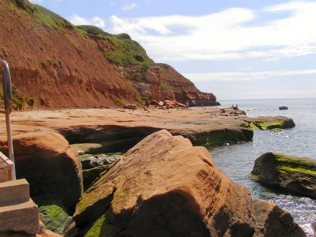
Photo of the red sandstone shore and sea with cliffs behind near Orcombe Point in Exmouth
Sandstone near Orcombe Point Credit: David Dixon

You can explore more in this area

Photo of a stream through fields on the East Devon Way
38miles/
60kms

East Devon Way

This 38 mile/60km path takes you from Exmouth in the west to Lyme Regis, Dorset in the east, and follows
Photo of cyclists on the Tarka Trail alongside the estuary near Instow
16.4miles/
26kms

Exe Estuary Trail

This newly constructed cycle trail offers an almost entirely traffic-free, wonderfully level route which forms part of the South Coast
Photo of cyclists on the Tarka Trail alongside the estuary near Instow
16.4miles/
26kms

Exe Estuary Trail

This newly constructed cycle trail offers an almost entirely traffic-free, wonderfully level route which forms part of the South Coast
Photo of a stream through fields on the East Devon Way
38miles/
60kms

East Devon Way

This 38 mile/60km path takes you from Exmouth in the west to Lyme Regis, Dorset in the east, and follows
Photo of cyclists on the Tarka Trail alongside the estuary near Instow
16.4miles/
26kms

Exe Estuary Trail

This newly constructed cycle trail offers an almost entirely traffic-free, wonderfully level route which forms part of the South Coast
Photo of walkers on the Exe Estuary Trail looking through binoculars
2miles/
3.2kms

Exe Estuary Trail: Exmouth to Lympstone

Exmouth to Lympstone is just one section of the Exe Estuary Trail, a multi-use route being built by Devon County
Photo of walkers on the Exe Estuary Trail looking through binoculars
2miles/
3.2kms

Exe Estuary Trail: Exmouth to Lympstone

Exmouth to Lympstone is just one section of the Exe Estuary Trail, a multi-use route being built by Devon County