Interesting information
Dartmoor’s western fringe contains two medieval treasures, Brentor church and the village of Lydford. Add to that the spectacular natural feature of Lydford Gorge and Dartmoor’s moorland scenery and the area’s attractions become obvious. All these are linked by one of Devon’s long-distance walking routes, the West Devon Way, as it makes its way between Plymouth and Okehampton.
Lydford is a real historical gem and you should find the time to look around either at the beginning or end of the walk. There may have been an early Celtic settlement here, but the present village is the result of a deliberate act of town planning in Saxon times. The Saxon street layout and remains of the Saxon town walls may be seen. Lydford was one of Devon’s most important sites in those times and included a Royal Mint. Later, it acquired a Norman fort and a medieval court and prison, now known as Lydford Castle. There is more information in the church and on a board at the car park. The bus stop is opposite the Castle In by the car park.
Mary Tavy has a history as an important centre for tin and copper mining, many remains of which may be seen in and around the village.
The Royal Standard, in about 300m/330 yards.
Bal Lane’s name is an indication of the village’s mining past. Bal is a Cornish word for “mine”, a name which could have been brought here by Cornish miners working in the locality. A house called Wheal Friendship will be seen this is the site of one of Mary Tavy’s mines, Wheal Friendship, allegedly one of the largest copper mines in the world for a while during the 19th century. Wheal is another Cornish word, meaning “workings”. The area the track passes through is one of old mine workings. It can be explored using existing paths, but do not stray off as there are numerous old shafts.
Mary Tavy’s village shop is a short way along the main road.
Brentor church, St. Michael de Rupe, is a significant landmark over much of West Devon, and features on the West Devon Way waymarks. It occupies the plug of an old volcano, 1,100ft/335m above sea level and dates from the 12th century, the tower being added a little later. The West Devon Way does not actually reach the church, which is well worth visiting in its own right.
There are also wide views back over Mary Tavy and her brother, Peter Tavy, and beyond into Dartmoor and down to the coast near Plymouth on a clear day. This vantage point is Black Down, the most westerly extremity of Dartmoor’s moorland. Up to the right is Gibbet Hill. Here the gallows stood, the corpses being left to hang after death to deter other potential wrongdoers.
As the path bears right and begins to descend, there are views over Brentor village and its “new” church, built in the 19th century in a more convenient location for the parishioners than the old one.
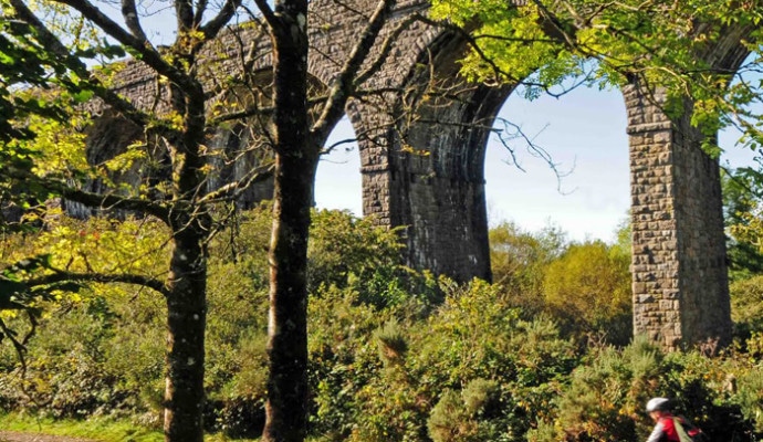
On the edge of the moorland are the lines of two parallel but separate railways. One was the Southern Railway’s main line from London to Plymouth and the other the Great Western’s branch line from Tavistock to Launceston. These two shadowed each other over the 9 miles between Tavistock and Lydford. Both fell victim to the Beeching cuts of the 1960s and are now maintained as butterfly reserves.
At Lydford Junction, the overgrown area to the left of the bridge is the site of the old station. Underneath the bridge ran the main line between Waterloo and Plymouth.
The preferred West Devon Way route passes through the National Trust’s Lydford Gorge to reach the village at Lydford. The Gorge is usually open between April and November. Alternatively, and during the winter, it is possible to walk along the road back to Lydford.
Walking through the Gorge is a superb experience but note that it can be slow and slippery going in places, especially where the path crosses wet rock.
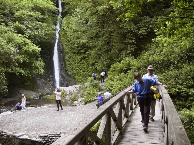
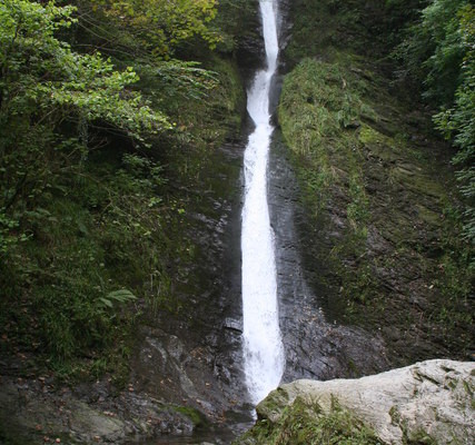
Incidentally, even during the winter when the Gorge is closed, access to the waterfall is usually possible and is well worth the effort for the spectacle.
The Gorge has been cut by the River Lyd, and the path closely follows the river. It offers a superb experience with the river and its rapids, small waterfalls and whirlpools, as well as the luxuriant woodland and the sound of birdsong. However, to repeat, it can be slow and slippery going in places. It also seems to have a microclimate of its own and you are likely to reach the other end feeling rather warm!
Now a positive attraction, in the past the Gorge was a place to be avoided. In the 18th century it was said to be inhabited by the Gubbins family, amongst whose vices was said to be making a meal of unwary travellers passing through the Gorge.
One of the notable stretches is in the middle, at Tunnel Falls, with its whirlpools as well as waterfalls. Even more spectacular is the Devil’s Cauldron at the far end, so be sure to follow the signs there.
Your ticket entitles you to continue on the high path above the Gorge back to the White Lady. You could do that, but will need to walk the Gorge itself again to return to the village


