Interesting information
The first length of the Dart Valley Trail out of Totnes links the town to the village of Ashprington. There is also a cycle route between the two which is largely parallel to the Dart Valley Trail, although the routes share some short lengths. It is therefore possible to walk from Totnes to Ashprington and back using mostly different paths.
An added attraction to such a walk is a diversion to the riverside vineyard and cheese making centre at Sharpham, and there is a further option of an extension from the walk to a picturesque riverside inn – plenty of options, so take your pick, all provide a superb walk, let alone the attractions to the appetite.
Totnes is a superb little town of great attractiveness and also great interest. Only a small proportion of its interest is seen on this walk – it is well worth exploring further.
Notice at the end of The Plains the memorial to William John Wills, a Totnes man who with his companion Burke was the first man to cross the Australian continent in the 1860s.
Originally a riverside marsh, The Plains later became Totnes’ industrial quarter. The restored buildings on the left are mostly old warehouses and behind them is a leat, an artificial watercourse originally used as water power.
Notice along the walk a brown and yellow waymark for the John Musgrave Heritage Trail. John Musgrave was a Torquay man who left a legacy for a long distance footpath to be set up to encircle Torbay. This route links Maidencombe at the northern end of Torbay to Brixham, via Totnes. This length out of Totnes uses the same route as the Dart Valley Trail.
The lime kiln is probably of 19th century origin. Lime was brought in by the river, probably from Torbay, and burnt here before being spread over the local fields to fertilise the soil.
Baltic Wharf was developed in the 1960s for the timber trade. Reeves and Co had begun importing timber from the Baltic region early in the 20th century. The trade has now gone but the name remains.
The path continues parallel to the River Dart. On the opposite side of the river are workshops occupying what was until the early 20th century Town Marsh.
Just before the marshes can be seen the remains of the old Totnes sewage treatment works, gradually disappearing into undergrowth.
On the right are the remains of an old quarry, which once supplied building stone for Totnes and the farms around. Until the 1800s, most parishes of Devon had a small quarry to provide local material for building.
There are good views over the reed beds to the river and the opposite side of the valley.
On the hillside on the opposite side of the river can be seen the buildings at Windwhistle Cottage. The winds here are said to be so strong that it was built with no windows on its north-facing side. The last occupant had nineteen children and as many cows and sheep in the adjoining barn.
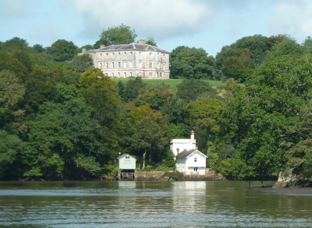
Sharpham House was re-built in its present form in 1765 by Captain Pownall, who had acquired a fortune by capturing a Spanish galleon. The gardens were laid out by the famous Capability Brown.
On the right is the village church. This is one of the few in England dedicated to St David, and may represent a very old Christian site. The body of the church dates from the 15th century, although the tower is older, from the 12th century. Notice the prominent stair turret on one corner of the tower.
In the 19th century Ashprington was very much an estate village, based on Sharpham House. The estate cottages in the village were built at that time. Langham House was built in the mid 19th century as the village school and master’s house by Richard Durrant of Sharpham. The village pub, the Durrant Arms, also dates from the same period although the foundations are earlier.
The bridge was built in the late 1600s, widened in the 1800s. It carried the road over Bow Creek, one of the many picturesque creeks branching off the lower Dart. Together with the Waterman’s Arms alongside it makes a very attractive location.
Again the views up the Dart Valley and on to Haytor on the skyline are very impressive.
There are views to Totnes Bridge, the town centre and Bridgetown Church.

