Interesting information
The Art Centre was originally St John’s Chapel, built in the 1830s to serve the inhabitants of the village, whose parish church is a couple of miles away at the hamlet of Stoke. Previously, a Town Hall had stood here, Hartland having been created a borough in medieval times with a market and annual fair. However, it was always too isolated to thrive and the market ceased about 1780. The Town Hall clock, from the 1620s, remains in the chapel.
The lane descends into the wooded valley of the Abbey River, a major landscape feature crossing the Harland peninsula. At this inland location the river is also known as Pattard Water.
The route climbs out of the Abbey River valley and is giving some splendid views. Prominent is the hamlet of Stoke, with the tower of Hartland parish church particularly obvious. The tower is the second highest in Devon, and has served for centuries as a landmark for mariners.
Cheristow’s name means “place of the church”. This seems to refer to an ancient chapel here, dedicated to the Cornish St. Wenn. The whole parish seems to have an association with ancient Celtic saints, the parish church being dedicated to another, St. Necton, who is said to have established a hermitage at a holy well nearby.
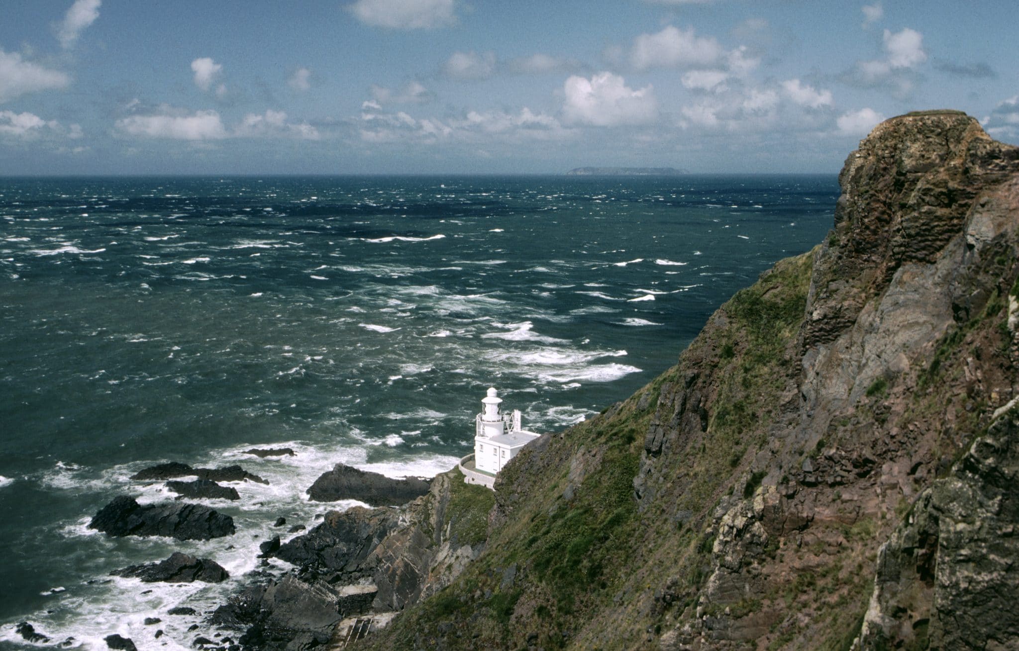
The almost peninsula-like nature of the area becomes apparent as the sea becomes visible. Hartland is not really a true peninsula, as it is faced by the sea on only two sides, but certainly has the character of a land’s end. As the descent to another valley begins, the outline of Lundy should become visible on the horizon, together with the radar “golf ball” near Hartland Point.
East Titchberry is a 15th century farmstead. In front of the main house is a cob and thatch former granary dating from the 1600s. Some information on the farm and its history and working is given on the National Trust information board next to the path.
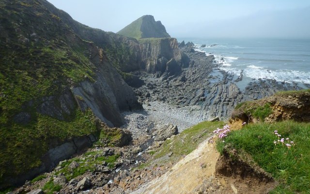
There are some superb views of the spectacularly twisted rock strata in the cliffs of Shipload Bay. As the Coast Path approaches the radar “golf ball” via a series of stiles, the view to sea focuses on Lundy, 11 miles/18km offshore in the middle of the entrance to the Bristol Channel.
The lighthouse was built between 1872 and 1874 of rendered stone hewn from the rock on site. Before its building the location was virtually inaccessible and a new road had to be specially built.
On the foreshore can be seen the remains of the wreck of the “Johanna”, which was driven ashore in gales in 1982.
This is the far north west point of Devon, where the Bristol Channel meets the Atlantic Ocean, and the effect of this sharp corner of land on the currents will almost certainly be seen, the sea off offshore usually showing signs of disturbance. The Point is said to have been famous in antiquity, and it is claimed that what is called the “Promontory of Hercules” in a Roman geography refers to Hartland Point.
The superb length of coast, characterised by long bony “fingers” of rock stretching out into the sea. The cliffs here are the first land that the Atlantic has encountered since North America, and they may have to withstand pressures of 3 – 4 tons per square foot in a rough sea.
The valley, known as Smoothlands, is the result of geological processes diverting the stream that used to flow along the valley and which formed it so that it now flows directly into the sea. The valley is separated from the sea by the impressive sheer cliffs of Damehole Point, itself the result of erosion by the sea.
The Coast Path climbs away from the beach, as far as the stile at the top of the first climb, where we leave the Coast path for the return cross-country leg to Hartland village.
The track bends to run along the lip of the valley. This is the valley of the Abbey River again, the same as was crossed just after leaving the village. The river’s mouth can be seen just behind and below, a superb location.
There is another good view of Hartland’s parish church at Stoke down to the right from the road junction. Hartland was owned in Saxon times by the royal family, and in 1050 a church was established by Gytha, mother of King Harold, as a gesture of thanks for the saving of her husband from a shipwreck. The present building dates from 1360 and is both interesting and beautiful. Its features include one of the finest late Norman fonts in the country and a fine medieval rood screen.
Looking back can be seen the outline of the folly seen earlier. Its position makes it a prominent part of the view as seen from Hartland Abbey, which is in the wooded valley.
Near the bottom of the lane is the entrance to Hartland Abbey. This traces its origins to an 11th century Normal establishment. Fragments of this early building remain in the present house, in private ownership since the Dissolution of the 16th century. It was largely rebuilt in 1779. On the other side of the road are the gardens, planted with advice from Gertrude Jekyll.

