Interesting information
The Old Mill Café was formerly a water-powered corn mill. The sitting area outside the café is the old wheel pit and old millstones are used for café tables.
The area was the subject of plans in the early 20th century to create an enormous harbour area which it was hoped would rival Liverpool and Southampton as a passenger port. Fortunately for the local landscape, the scheme never progressed.
Churchwood Valley was to be the route of the railway access to the Wembury dock scheme mentioned earlier.
Ford is the location of the family cottage of the Galsworthy family. John Galsworthy, author of “The Forsyte Saga”, often visited, and Wembury and its church is used as the description of one of the Saga locations, although placed in Dorset in the book.
Knighton is an ancient settlement in its own right. First recorded in 1281, although almost certainly earlier in origin, it now largely forms a residential part of Wembury. This is the location of the village school, and there is a shop and pub.
The stone wall surrounds Wembury House. The current house dates from 1803, built on the site of an earlier house. Earlier still, the site had been the location of a cell, or “branch” of Plympton Priory. The buttressed wall alongside the path is the only remnant of this building.
The wide green lane gives views back to the edge of Dartmoor and glimpses ahead of the village of Newton Ferrers to the left and the sea to the right. As the lane descends, superb views open up of the estuary of the River Yealm.
Rocket House was given its name as it was earlier used to store coastguard apparatus, including rockets used for flares and for launching lines to ships in trouble.
The leads to a superb viewpoint over the Yealm and the riverside village of Newton Ferrers.
The seasonal ferry forms the Coast Path link across the river to Noss Mayo, but also operates to and from Newton Ferrers.
Mew Stone name derived from the Saxon word for “gull”, the Stone is owned by the Ministry of Defence. For a while it was used as a prison, a criminal being sentenced to live there for seven years in the 1700s. Later, Sam Wakeham, a rabbit warrener, lived there and supplied rabbit meat to Langdon Court.
From Wembury Point, can be seen the buildings of the shore base HMS Cambridge. Until recently this was the site of the Royal Navy’s gunnery school, and the noise of the guns was frequently heard echoing across the bay. It has now been acquired by the National Trust.
Beyond, the far headland with the distinctive triangular shape topped by a narrow needle shape is Rame Head, guarding the western entrance to Plymouth Sound. The needle is actually St. Michael’s Chapel, said to be Norman in origin, and long used by sailors as a landmark for Plymouth.
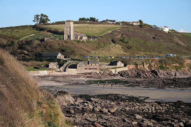
The church is, unusually, dedicated to St. Werburgh, a Saxon saint. It holds some interesting memorials to local families. Once very remote, the church and its 14th century tower was also important as a landmark for sailors approaching Plymouth.
It is worth looking around the Wembury Marine Centre [open Easter-September] for information on the local marine wildlife which has led to the bay being designated as a Marine Conservation Area.


