Interesting information
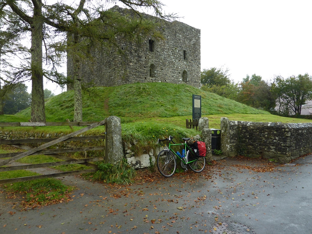
The large square stone tower next to the pub is Lydford Castle. Although always referred to as the castle, it was actually built as a prison in 1195. It was rebuilt in the 13th century, when the ground was built up around the base. Prior to that, it would have stood even taller. Its function was to act as the prison for those who broke the stannary laws. These were laws applying to Dartmoor tin-mining, and were administered by special courts which were notoriously harsh.
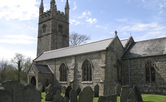
Next to the castle is the church. Although the church dates from the 13th century, it seems it stands on a very early Christian site. The churchyard forms an embanked area, usually the sign of an early site, and the dedication to St Petroc indicates a probable Celtic origin, perhaps pre-dating the Saxons’ arrival at Lydford.
Behind the churchyard is a grassy area and at the far end of this are a series of mounds. These are the remains of the “real” Lydford Castle. This was built as a Norman fort in the late 11th century, shortly after the Battle of Hastings. As can be seen it occupied an impressive defensive position at the end of the ridge on which Lydford stands.
One of the reasons why this early castle was built was that in Saxon times Lydford was a very important settlement. It was one of four Saxon boroughs established by Alfred the Great as a defence against the Danish invasions. It was an early planned town and there are still signs of the original grid pattern established as early as the 880s. It was one of the relatively few walled Saxon towns and also had a mint, producing coins from the 970s until about 1050. These have been found in Scandinavia, presumably taken there as part of a “Danegeld”, or Viking protection money.
Note on the track between the castle and the church there is a runic stone. This was erected in 1997 to commemorate the 1000th anniversary of the Viking raid on Lydford.
As time went on, Lydford’s military importance was replaced by Okehampton and Launceston and its commercial importance by Okehampton and Tavistock. Consequently, while those settlements grew, Lydford if anything shrank, famous only in the later middle ages for its harsh stannary law and grim prison.
Look out for a bridleway which marks the line of one of the Saxon streets of the planned town. The line of the wall is just before the Nicholls Hall is passed.
On the skyline of Dartmoor is Widgery Tor, clearly crowned by a cross. The cross was erected in 1887 to mark the golden jubilee of Queen Victoria. William Widgery was a stone mason who lived in what is now the Lydford House Hotel. Widgery Tor is also known by its earlier name of Bratt Tor.
The Granite Way is the name given to that length of the National Cycle Network which runs along the western edge of Dartmoor. It forms part of the Devon Coast to Coast cycle route between Ilfracombe and Plymouth, National Cycle Route number 23, but also forms a useful route for walkers.
The railway here was part of the London and South Western Railway’s main line between London Waterloo and Plymouth. Although Plymouth was not reached until 1890, this part of the line was completed in 1874. Express trains used this route for much of the 20th century, until it was closed to passengers in 1968.
As the track emerges from the cutting the edge of Dartmoor becomes clear. There is a superb view over the valley of a tributary of the river Lyd.
On the right as you cross the bridge, the private house occupies what used to be Bridestowe Station. This quite remote station was actually a couple of miles from the village of Bridestowe. Passengers seeking the solitude of Dartmoor would use the station, and it was also used for the shipment of rabbits from the Dartmoor warrens to London for cheap food.
The lane is lined with trees, and often used to be referred to as Bridestowe Cathedral, from the likeness to a cathedral aisle.
The original main road to Lydford from Okehampton, Is now makes a pleasant track and an ideal way to pass quietly through the countryside.
The grassy moorland is Fernworthy Down, a western outlier of Dartmoor. It is a superb length of the walk and gives splendid views in all directions.
Note the evidence of mining and quarrying activity around here. There used to be iron workings in this area in the 19th century.


