Interesting information
Sidbury is an attractive village in the Sid Valley. It is of Saxon origin, probably being one of Devon’s earlier settlements. Among its attractions is the church, which has elements of almost every period of English church building. This includes what appears to be a Saxon crypt, possibly the only example of Saxon work in a Devon church. The village was once an important centre, receiving a royal warrant to hold a market and fair from 1290.
The Court House was originally Sidbury’s Manor House until a new one was built outside the village in the 19th century. The front is 16th or 17th century in origin, although there are also later additions.
The Manor, was built in 1879 for Sir Stephen Cave MP, a member of Disraeli’s cabinet. The Cave family still lives there.
The track is the route of the East Devon Way and on the gate is an East Devon Way waymark and a purple arrow, the mark of the Way and a good guide for the outward leg of the walk. The colour is based on the foxglove, the Way’s logo.
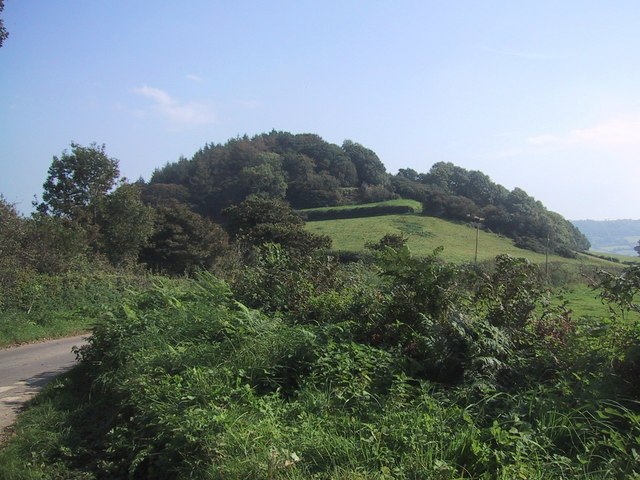
Sidbury Castle, an Iron Age hill fort. Despite its name, there is no built castle. However, the hill fort gave its name to the village, the “bury” part of its name being the Saxon name for fortification.
There are many views up the Sid Valley can be obtained along the walk.
The characteristic features of this part of the East Devon landscape, a narrow gully or “goyle” as they are known locally. These goyles tend to be cut into the sides of the main valleys, and add variety to the landscape.
The walk has now reaches the plateau top of the ridge separating the Sid Valley from the valley of the River Otter which runs parallel, the landscape here is quite different from that of the valley and valley sides. Up here the terrain is generally flat with large fields with straight hedges, compared with the steeper terrain and smaller, irregular fields lower down. This contrasting scenery is typical of the East Devon valleys and ridges.
Just to the right of White Cross is a car park and from here there are wide views over the Otter towards Exeter.
The ancient trackway, leading from the old ridge route, probably prehistoric, to the old river crossing at Sidford.
Nearing to Sidbury Castle and there are good views of this side of the hill fort and its earth ramparts from here. Sidbury is one of a series of Iron Age hill forts found on the East Devon ridges.
The lane now descends back into the Sid Valley, alongside Sidbury Castle high up on the right. As the lane drops, Sidbury village comes into view and the walk passes a number of picturesque cob and thatch cottages. Most date back to the 17th and 18th centuries and one, Little Thatch on the right, is dated 1621 on the chimney.

