Interesting information
Appledore was established as a town in the Middle Ages, being first mentioned in the 1300s. From those early times it was an important fishing and trading centre. At one time it became one of England’s biggest importers of tobacco. The Quay itself was built in the mid 1800s to replace a series of individual jetties serving the separate houses. Most of the current houses along the Quay date from the 1840s.
On the opposite side of the estuary can be seen the village of Instow. Beyond the church tower at the left hand end can be seen the stump of an old windmill on the hill. As the road bends to the right the old shipbuilding quays can be seen on the left. Shipbuilding was a significant industry in Appledore in the 18th and 19th centuries, arising from the North American trade, and continues to this day. The main yard visible is Richmond Yard, which included a dry dock capable of taking four schooners at a time. Beyond was the Newquay or Top Yard.
The shipbuilding tradition continues at Appledore with what is known as the Bidna Yard. When built in 1969, this was one of Europe’s largest covered yards, and is still quite impressive. It is now operated by DML of Plymouth.
Upstream can be seen Bideford beyond the new high level bridge. The Torridge estuary is very attractive. The river itself follows a strange semi-circular course, since it rises near the north coast near the Cornish border then flows south and east before turning back north to flow into the sea here.
Bloody Corner is thought to be the site of a great battle in the early Middle Ages. It is usually associated with the defeat of a Viking invader, Hubba the Dane, by Alfred the Great in 892AD. Note the commemorative stone at the top of the footpath. However, some historians have deduced that the battle was in 1069, involving some of the sons of Harold after the defeat at Hastings.
Northam is the earliest settlement in this area. The church tower is a notable landmark, and indeed was historically important as a guide for shipping. The distinctive building in the Square is the former school. It looks old, but only dates from the 1800s, being built in an antique style, though it does in fact incorporate some genuine medieval work.
The Burrows was traditionally an area of common land where parishioners had grazing rights. It is now operated jointly as a Country Park by Torridge District Council and as a golf course, said to be the oldest links course in England. The area consists of sand and alluvial deposits, with scattered pools. It provides a wide range of coastal habitats, especially for rare plants and migratory birds. As a result it is designated as a Site of Special Scientific Interest.
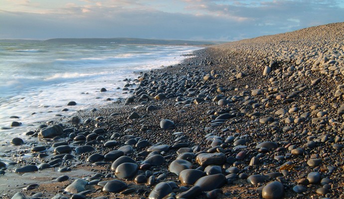
High pebble ridge is another noteworthy natural feature, said to be formed by erosion over the ages of costal rocks to the west, washed up here by the tides and flung up the shore to form the ridge. The ridge is absolutely vital for the survival of the Burrows.
From the top of the ridge there is a superb view of the whole of Bideford (or Barnstaple) Bay, from Hartland Point on the left to Baggy Point on the right. The expanse of sand, sea and surf makes an exhilarating sight.
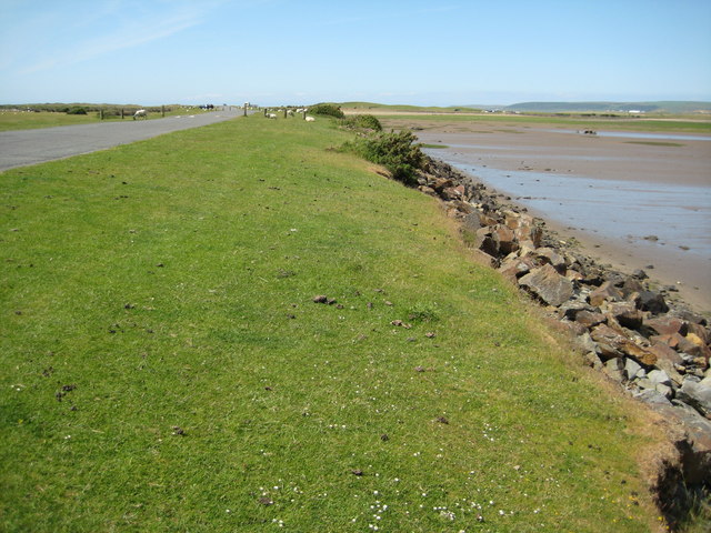
The path is passes alongside the edge of the joint estuary of the Taw and Torridge rivers. On the opposite side of the estuary will be seen the dunes of Braunton Burrows, one of the largest areas of sand dunes in England. The area was designated as a Biosphere Reserve in 2002 by UNESCO for its environmental and scientific importance. It is Britain’s first Biosphere Reserve, a designation which gives it world status. Along the edge of the Burrows, the two arms of the estuary can now be seen, the Taw on its way from Barnstaple and, ultimately, Dartmoor ahead and left while the Torridge passes between Instow and Appledore ahead and right.


