Interesting information
In summer it is possible to shorten the walk by omitting the leg of the walk into and out of Salcombe and instead using the South Sands Ferry. This very scenic boat trip reduces the walking by approximately 2km/1.25 miles each way. Alternatively, car users can use car parks at North Sands or South Sands which also shorten the walk.
The walk starts in Salcombe at the junction of Gould Road and Island Street. The main bus terminus in Salcombe is in Gould Road, and the park and ride service also stops along the Gould Road.
Island Street name suggests this little headland extending into the estuary was once an island, although there is no trace of this now. Island Street backs onto Shadycombe Creek, one of the side creeks off the main estuary, and is lined by boat repair shops and yards, many of them looking much the same as they would have done a hundred years ago. At that time the “Island” built small wooden ships, coasters and “fruit clippers” for the Azores fruit trade.
Whitestrand Quay is where the South Sands Ferry sails from.
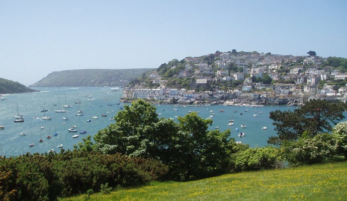
There is a road along the route that gives attractive views over the estuary and down to Bolt Head at its mouth. Look out for the sand spit of The Bar across the mouth of the estuary. The Salcombe lifeboat was lost here in 1916.
On one side of North Sands the remains of Fort Charles can be seen alongside the estuary. This was built at the time of Henry VIII and was effectively destroyed after its capture from the Royalists during the Civil War.
You will notice there is an entrance to a house called The Moult. Although Salcombe traditionally flourished on shipbuilding with some piracy and smuggling thrown in, its picturesque location began to attract the well-to-do from the 18th century. Today, spacious villas are a feature of Salcombe’s outskirts and The Moult was the first of these to be built, dating back to 1764.
Combe valley is cut by one of the tributary streams flowing into the Salcombe Estuary.
The walk passes the appropriately-named hamlet of Soar. However, the name apparently reflects not its high location but the Old English word for the plant sorrel, which presumably grew here.
Soar Mill Cove can be an idyllic spot on a sunny day, but it is not always like that. In 1887 the tea clipper “Hallow E’en” was wrecked here. In 1936 another storm ran the 4 masted sailing barque, “Herzogin Cecilie”, onto the Ham Stone, the large rock just offshore. It was refloated and towed to the shelter of Starehole Bay, at the mouth of the Salcombe Estuary, but another storm a couple of months later finally sank her.
The walk follows the Coast Path back to Salcombe for a short time, and is well waymarked with the acorn symbol.
One of a number of lengths on the South Devon coast with this name, it reflects the importance of rabbit meat in the diet in medieval times, when warrens were deliberately established in these areas to provide this resource.
Stone walls are not generally a feature of the Devon countryside away from Dartmoor, but are found locally on these South Devon coastal plateaux, making use of the local mica schist rock.
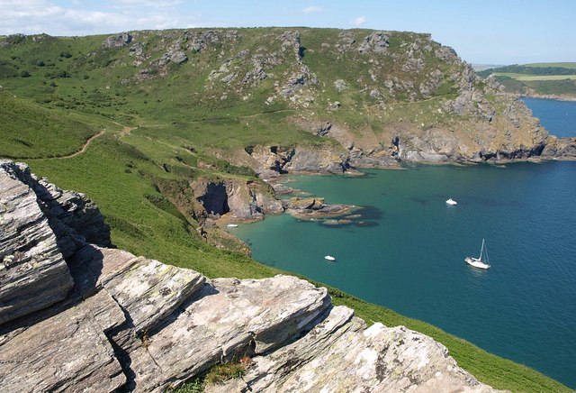
The path passes the remains of a World War II observation post on Bolt Head then, as it rounds the headland into the estuary, gives views along the coast opposite to Prawle Point, the most southerly point in Devon.
As mentioned earlier, the “Herzogin Cecilie” ended her days here and the outline is supposed to be visible in the clear water at low tides.
Courtenay Walk, cut in the 1860s by Viscount Courtenay, son of the Earl of Devon, to allow visitors to Salcombe to reach Bolt Head.
Overbeck’s is a National Trust property, named after a German eccentric Otto Overbeck who owned it, contains a collection of oddities from around the world which he collected on his travels.

