Interesting information
Braunton is generally referred to as the largest village in Devon and certainly, with all its facilities, it has most of the trappings of a small town. In earlier days it also acted as a small port, with a quay just outside the town. Until the early 1800s it was generally known as Branton, its name being changed by the Ordnance Survey when they produced their first detailed map of the area.
The river Caen rises in the high land to the north of the village. It was Braunton’s link to the sea in earlier days, when it was often known as Braunton Pill, pill being a common name for a tidal creek or small river on this coast.
At Hordens Mill there is a sign on the wall indicates that it was established in 1254, although the current buildings are later. It was established as a water mill using the power of the river.
The Great Field is one of only three such communal open fields left in the country, although it is now worked by only a handful of farmers. Braunton was a royal manor from Saxon times until the 1200s, when portions of the field were given away to various lords, causing divisions within the field. Other land owners also had holdings in the field. This complicated arrangement may have helped retain the open field system intact, when most other such fields were lost during the late Middle Ages.
The field was divided into strips each one furlong long (220 yards/200m) by either 5½ or 11 yards (5 or 10m) wide. The strips were separated by unploughed land known as “landshares”, although these were later ploughed out. It covers some 350 acres/140 ha; in 1840 it was recorded that it was divided into some 600 strips in 60 ownerships. Both numbers of strips and owners are now much reduced.
On a bright day it is very atmospheric in the middle of the Great Field, framed by the heights of Saunton Down on the right and with the dunes of Braunton Burrows ahead. The track passes the ends of some obvious remaining strips.
Braunton Marsh, will be virtually encircled by this walk. The marsh was extensively drained during the period 1811-15 by the building of the Great Sea Bank, by the well-known engineer James Green. However, early reclamation was taking place as far back as the Middle Ages.
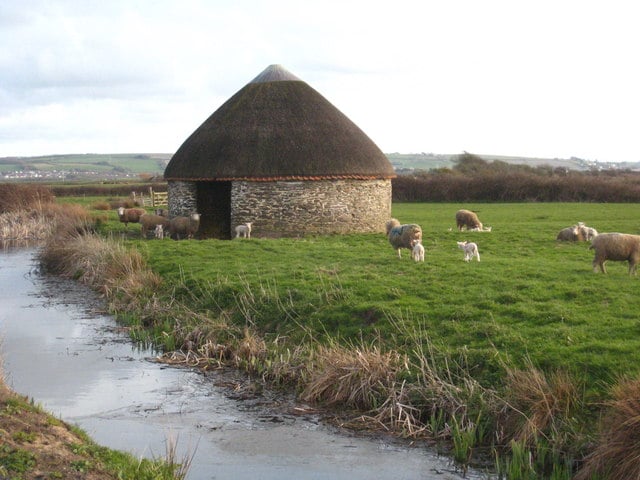
The barns are known as linhays. Most were built during the period 1815-20, soon after the marsh was finally reclaimed, and were used for cattle shelters and fodder stores.
The South West Coast Path, together with its accompanying Tarka Trail here, officially follows a line behind the dunes of Braunton Burrows. However, most Coast Path walkers probably walk the length of Saunton Sands on the far side of the dunes, unless the tide is really high, then pick up the official path near Crow Point, which is ahead.
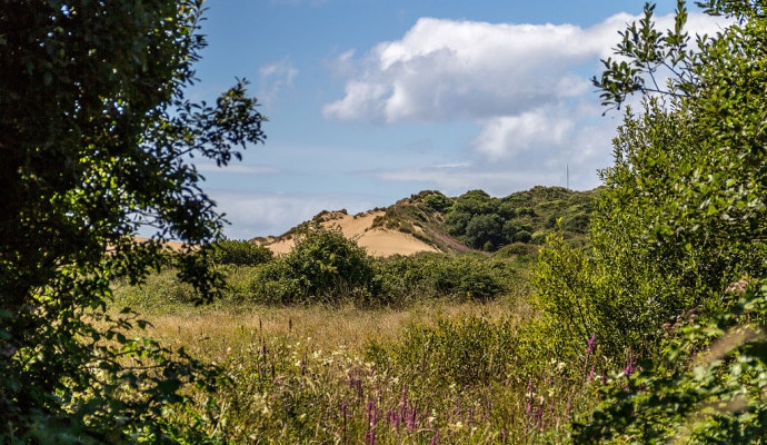
Braunton Burrows forms one of the largest areas of sand dunes in England. The area was designated a Biosphere Reserve by UNESCO in 2002 for its environmental and scientific importance. It is Britain’s first Biosphere Reserve, a designation which gives it world status.
Note that as well as being environmentally and scientifically valuable, it also has a military importance as can be seen from the signs. Military use of the area dates from at least the Second World War; indeed, this track is known locally as the American Road since it was built by American troops at that time to allow military access to the Taw Estuary.
The White House, as it is always known, is a prominent landmark on the Taw estuary. It was earlier the Ferry House, the slipway alongside being the site of the old ferry to Appledore which fell into disuse in the 19th century. This was an important ferry crossing point on the North Devon coast. Nearby was the site of St. Anne’s Chapel, now lost in the dunes, and a road to Saunton once crossed the dunes from the ferry, also now lost.
The location gives a superb panorama over the joint estuaries of the Taw and Torridge rivers, the Taw on the left being joined by the Torridge from ahead and right. The exit to the sea is round Crow Point, the sandy headland to the right. On the opposite bank of the estuary is Instow. The prominent jetty was used to supply fuel to the old Yelland Power Station which stood on the shore opposite until the 1990s.
The walk now continues on the South West Coast Path and Tarka Trail. Look out for National Trail acorn symbols.
The area of marshland called Horsey Island, was reclaimed later than the rest of Braunton Marsh, between 1850 and 1857, by the building of the embankment and cutting of drainage ditches.
The embankment is a superb vantage point for views over the whole estuary area. Views encompass not only the estuary itself on the right but the marshes on the left and the rim of surrounding high land – notice the church tower of Heanton Punchardon – together with the settlement of Braunton itself.
The smaller river is the River Caen, crossed in Braunton at the start of the walk and historically Braunton’s access to the sea. On the opposite bank is the Royal Marines base at Chivenor, important among other things for its air-sea rescue helicopters.
Toll House is used to collect tolls on the private road to the White House. Old maps refer to it as the Inspector’s House. The River Caen has been straightened, the old course originally meandered to the east, towards the edge of the Royal Marines base, but was canalised to enable larger boats to approach Braunton.
Velator Quay was Braunton’s main quay, although it is a little way out of the village, since the river becomes too small for boats of any size beyond here. The quay was used especially for imports of coal from South Wales and limestone from Pembrokeshire; exports included clay and gravel for pottery and building, as well as agricultural goods.
Velator bridge was built in 1815 by James Green, the eminent engineer who also built the Great Sea Bank to reclaim Braunton Marsh. This is another prominent Tarka location, the otter having to bite off his own toes having been caught in a gin trap here.
The line of the old railway between Barnstaple and Ilfracombe can be found along the walk. Built in 1874, it became the line of one of the arms of the Southern Railway’s Atlantic Coast Express. It was closed in 1970.


