7miles/
11kms

Budleigh Salterton Pines, pebbles and plantations

About this route

This walk is in East Devon. It is based around the charming seaside town of Budleigh Salterton and forms a circuit, partly inland and partly using the South West Coast path.

If you prefer, you can continue the inland route into Exmouth rather than turning to Budleigh Salterton.

Getting Around

By bus: Budleigh Salterton is accessible by bus from Exmouth and Sidmouth. Journey time 15 minutes from Exmouth, 25 minutes from Sidmouth. For latest bus times see the Travel Devon website.

The walk begins at the eastern end of Budleigh Salterton at the estuary of the River Otter.

Facilities
Budleigh Salterton: (all facilities); Littleham: (pub); Sandy Bay: (cafe April - October).
Terrain
One climb on the Coast Path section of 80m/250ft. 4 Stiles, all on the Coast Path section. Inland part of the walk uses a former railway so it is suitable for use by cyclists, wheelchair users or a pushchair walk.
Accessibility
Explore more, click to download pdf
Download

Interesting information

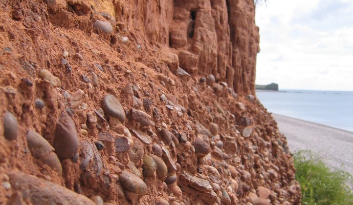
Budleigh Salterton is a charming seaside town with a very much a traditional, “olde -world” character. This unspoilt character is partly a result of the pebbly beach, which prevented it from ever becoming a resort for large scale tourism. The pebbles are part of a band of infertile land known as the Bunter Pebble Beds, laid down over 200 million years ago in river beds of the time.

Near the start of the walk you will see an old lime kiln at the entrance to the car park. Lime was landed by ship and burnt in kilns such as this to improve the fertility of the soil. This one dates from the early 1800s.

A bar of pebbles has built up across the mouth of the River Otter, forcing its course to the east. Behind is an attractive landscape of salt marshes, now managed as a nature reserve. Historically, the estuary was used by shipping as far inland as Otterton, 3.5 km/2 miles upriver, as indicated by the name Anchoring Hill just above that village. The mouth of the Otter is immediately recognisable by the line of pine trees on its eastern side.

Note the plaque on the white house on the seafront in Budleigh, relating to the artist Millais. The famous painting “The Boyhood of Raleigh” is said to have been based on the wall just behind you. Raleigh himself was born at Hayes Barton, 3.5km/2 miles inland.

Part of the route follows the former Exmouth – Budleigh Salterton railway. An information board by the gate gives some background information on the railway, which closed in 1967,

Along the line is a high bridge; popularly known as the “million brick bridge” it is an imposing structure seen from the road beneath, although it is uncertain whether anybody has actually counted the bricks. The number on  the bridge indicates it is 171 miles and 51 chains from the old London and South Western Railway terminus at Waterloo.

The line then enters an area of woodland and plantations. The unproductive nature of the geology of the pebble beds means that heathland and woodland are the main land uses in this area.

Continuing, the geology changes, and so does the landscape. The pebble beds give way to softer, more fertile soils which result in a landscape of green fields and farmland.

The route passes the 15th-16th century church in Littleham. This was one of the historical parishes on which the of Exmouth developed. It is now a suburb with buses to the town centre. It is also close to the entrance to Devon Cliffs Holiday Park at Sandy Bay and the World of Country Life Museum.
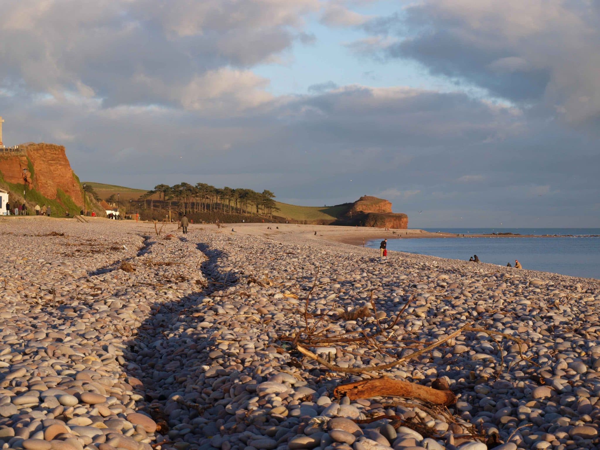
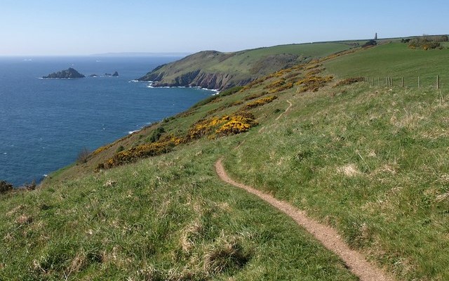
 

Photo of the view along the beach at Budleigh Salterton
Budleigh by Melanie Hinde

You can explore more in this area

Photo of cyclists on the Tarka Trail alongside the estuary near Instow
16.4miles/
26kms

Exe Estuary Trail

This newly constructed cycle trail offers an almost entirely traffic-free, wonderfully level route which forms part of the South Coast
Photo of cyclists on the Tarka Trail alongside the estuary near Instow
16.4miles/
26kms

Exe Estuary Trail

This newly constructed cycle trail offers an almost entirely traffic-free, wonderfully level route which forms part of the South Coast
Photo of cyclists on the Tarka Trail alongside the estuary near Instow
16.4miles/
26kms

Exe Estuary Trail

This newly constructed cycle trail offers an almost entirely traffic-free, wonderfully level route which forms part of the South Coast
Photo of a heath spotted orchid

Pebblebed Heaths

The magnificent East Devon Pebblebed Heaths complex is the largest block of lowland heath in Devon. The site’s large area
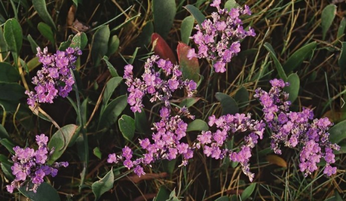
Photo of the pink flowers of sea lavender

The Otter Estuary

The Otter Estuary is a compact and accessible estuary, which supports a particularly well-developed saltmarsh flora that includes such characteristic
Photo of red cliffs and pebble bed layer above Budleigh Salterton Beach

Budleigh Salterton Cliffs and the Otter ..

The cliffs in the western part of Budleigh Salterton expose the full thickness of the Lower Triassic Budleigh Salterton Pebble
Photo of red cliffs and pebble bed layer above Budleigh Salterton Beach

Budleigh Salterton Cliffs and the Otter ..

The cliffs in the western part of Budleigh Salterton expose the full thickness of the Lower Triassic Budleigh Salterton Pebble