Interesting information
Tamerton Foliot is an historic village on the northern edge of Plymouth. Although now within the City area, it retains something of its rural past and is well placed for access to the countryside north of Plymouth. This is the area where the River Tavy ends its course, meeting the Tamar at a wide estuary, and it is the lower valley of the Tavy and its tributary streams that this walk explores.
Tamerton is an ancient settlement, recorded as early as the 6th century as the landing place of three Celtic saints, Indract, Dominic and Budoc. By the time of the Domesday Book it is recorded as “Tambretona” and by the 1100s it was in the possession of the Foliots, a Norman family who gave their name to the settlement. It continued as a farming and fishing community until the 19th century, when it began to prosper as the centre of market gardens supplying Plymouth.
There are some quite grand 19th century villas along this road, built for successful market gardeners. The Methodist Church also dates to this time.
This is a typical old Devon lane with high hedgebanks. Already the urban area seems far behind. After climbing gently, a vantage point is passed giving superb views over the Tavy valley, Bere Ferrers village prominent ahead and left. Behind is the distinctive landmark of Kit Hill and its chimney, a feature of views along much of the Tamar Valley Discovery Trail between Plymouth and Launceston.
The farmhouse is of 16th century origin, although the first record of a farm here dates to 1244. Behind the farm is the probable site of a deserted medieval village – N.B. there is no public access. The village could well have been abandoned at the time of the Black Death.
This is Pound Lane, the line of an old road which would have given access between the farms at the top of the hill and a quay on Blaxton Creek – this will be passed on the return leg of the walk. It is recorded as a road on the earliest Ordnance Survey maps of the early 19th century.
Pound Farm’s buildings are largely 19th century in origin, when the farm was surrounded by orchards, but its name indicates that it was presumably at an earlier date the location of a stock pound.
The large houses just before the junction are old almshouses. Both these and the school date from the 19th century and are associated with the estate of Maristow House, the local manor house to be passed a little later.
Note that this is not a right of way but access is permitted by the Maristow Estate from 1st February to 30th September. It is an old estate carriage drive and now makes an attractive woodland walk.
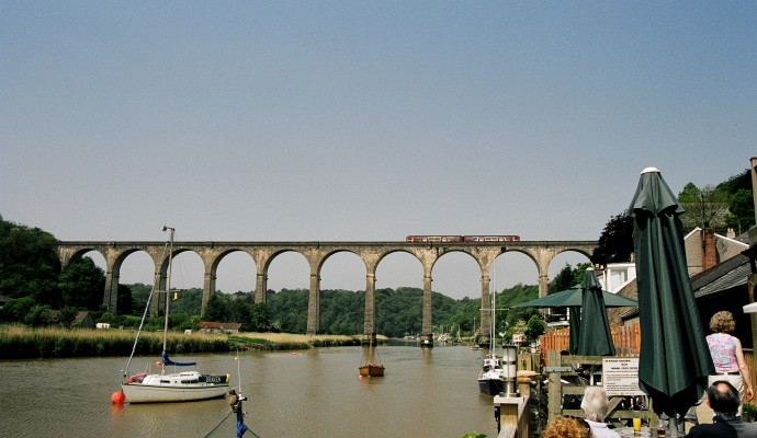
The walk has now arrived at the Tavy. There are superb views down the river to the railway viaduct where the Tavy meets the Tamar. On the hillside is Maristow House. The site is first recorded in 1291 as Martins-Stow, the site of an early chapel dedicated to St. Martin. The present mansion house dates from 1760, although the existing St. Martin’s Chapel with its conspicuous spire was built as late as 1877-79. The house was the centre of the local estate and the seat of the Lopes family (Lord Roborough) until the early 20th century. Note that there is no access to the house.
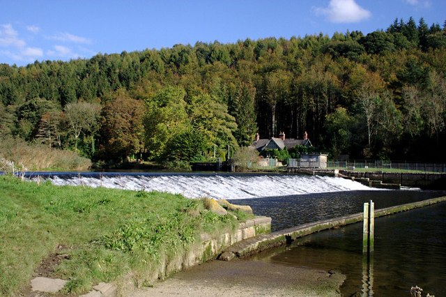
On the other side of the river are the remains of 19th century mines. At that time there was a small but thriving community here including a public house. Note that the ford and pedestrian walkway across the river is tidal and cannot be used for at least two hours either side of high tide. Tide tables are posted at the dam.
The walk has joins the Tamar Valley Discovery Trail, which is followed back to Tamerton Foliot.
This leads to another permitted path, although there is no time limit on the use of this one. It follows the embankment enclosing reclaimed land next to the Tavy. It offers a good opportunity to see the Tavy close up, a site of considerable importance for its wildlife. The mudflats and marshes and their reeds, seaweeds and sea-grasses mean that the area is of great value as a wintering site for wildfowl and waders. This importance has led to the whole estuary complex being designated as a Site of Special Scientific Interest.
The actual location of an old ford across the river is known as Chucks Ford, and still a legal right of way. After many years of disuse it was fairly recently renovated for use largely as a result of efforts by a local horse riding group. A little further on is Maristow Quay, first recorded in the 1290s when silver was shipped from the Bere Ferrers mines over the river to here and then on to London. The present boat house is 19th century.
The viewpoint over the Tavy was constructed in the 19th century for the benefit of the inhabitants of Maristow House. It provides a superb river panorama, over to Bere Ferrers on the opposite bank and also up and down the river. It is noticeable how much the river has widened to a true estuary in the short distance from Lopwell.
The mouth of Blaxton Creek was first crossed on the outward leg. Looking across the creek the remains of Blaxton Quay and its limekiln will be seen on the opposite side. Until the last couple of hundred years the rivers were the main means of transportation in the area and quays such as Blaxton were important places. There was also a tide mill here, the creek being dammed as a mill pond in use until the end of the 19th century.
The public footpath, a cul-de-sac leads to Blaxton Quay.
The farm is first recorded in 1270. However, the name is of Saxon origin, meaning the meadow where horses are kept.
The steep, enclosed and sometimes rocky green lane is Horsham Lane, an old packhorse track linking Tamerton Foliot with Horsham Farm and Blaxton Quay. Care may be needed near the bottom when the track is often wet and can be slippery.
This is the lodge to Warleigh House, probably built in the 18th century. There is a superb view from here over the Tamar into Cornwall.
Warleigh House has no public access. The house has medieval origins, but is chiefly Tudor (16th century) and 19th century. Originally the house of the Foliots, it has been the possession of a number of landed families.


