Interesting information
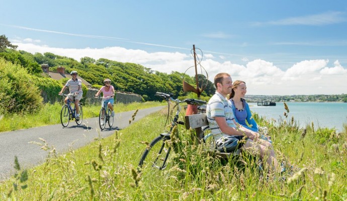
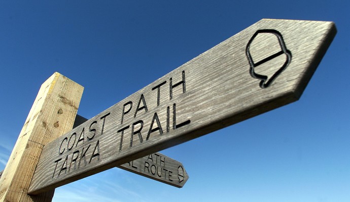
The Tarka Trail is a long-distance footpath route following a figure-of-eight course throughout northern Devon some 180 miles/290km in length. It traces the route taken by Tarka the Otter in the famous 1920s book by Henry Williamson. Over substantial lengths, the Trail follows former railway lines and is therefore promoted as a multi use trail, and is suitable for the less mobile, those pushing buggies and wheelchair users as well. A good centre as a base for using the Tarka Trail, and especially these more accessible lengths, is Torrington, some 12 miles/20km inland of Bideford.
The railway from Bideford to Torrington was built in 1872 as an extension of the line into North Devon from Exeter, and for many years Torrington was the terminus with a direct link to London. The length beyond, which our walk is now following, was originally built as a narrow gauge line to carry out clay from the pits further inland, but was replaced in 1925 by a standard gauge line which was also used for passenger traffic. The whole length beyond Bideford closed to passengers in 1965, although clay continued to be carried until 1982. When that traffic also went, the line was acquired by Devon County Council for use as a cycle and walkway.
The earlier narrow gauge line used a smaller trestle viaduct here. The present splendid structure was built in 1925 when the line became standard gauge.
The road over which the viaduct passes marks the line of a former canal. This, the Rolle Canal, was built for the local landowner Lord Rolle between 1820 and 1824 and stretched for 7.5 miles/12 km between the tidal Torridge and a little upstream of Torrington. It was abandoned with the coming of the railway in the 1870s, some of its course being used for the railway.
The viaduct gives a splendid view of the river. Upstream can be seen the road bridge built in 1928, and beyond the medieval Rothern Bridge dating from the 1400s.
This is the valley of Langtree Lake, a tributary of the Torridge. Note that the name does not imply the presence of a large body of water. In Devon, the name “lake” is often used for a stream or watercourse, being a descendant of the Saxon word of that meaning, “lacu”.
Our walk now leaves the Tarka Trail to embark on the cross-country section. It now follows a length of the Torridge Ramblers Millennium Path (TRAMP). It is a 20 mile/32km circular route around Torrington, set up by the local ramblers for the millennium.
This is the farm of Priestacott, the first of the locations on the route with historic religious connections. Its name seems to indicate it was founded by, or at least was inhabited by, a clergyman in early days. It may well have been associated with the old priory at Frithelstock, to be passed later on the walk.
The spot also gives superb views back over the wooded valley of Langtree Lake, now 200ft/60m below.
On the private lane is another farm, Pryston, its name indicating yet another priestly habitation in bygone days.
The high and airy length gives wide views over the countryside, including a view over Torrington ahead in the distance, its church spire quite prominent.
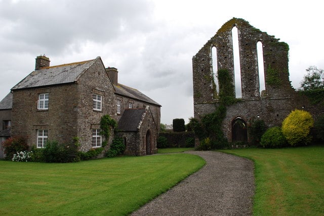
The route leaves the road along the footpath just after the farm buildings beyond the Frithelstock village sign. However, it is worth continuing for the couple of hundred yards along the road into Frithelstock village to see the important historic remains of Frithelstock Priory. Another priestly connection on the walk, this was founded by the Augustinians in 1229, as a subsidiary of Hartland Abbey. Dissolved by Henry VIII in 1536 it has been slowly crumbling away ever since.
If in need of refreshment, Frithelstock can also offer help in the form of a pub, the Clinton Arms.
The village of Monkleigh, its church tower prominent, now dominates the view ahead. With Monkleigh now close ahead, this area gives wide views over the countryside, Torrington being again especially prominent. Monkleigh was originally simply called “Leigh”. In the 1100s it was granted to the monks of Montacute Abbey in Somerset and the name was lengthened to avoid confusion with other places called “Leigh”. Another priestly connection on the walk, but no actual connection with Frithelstock or the priests’ houses passed earlier.
The church, a little way to the right, is very old, although its modern form is based on a rebuilding in the 1400s, still old enough. Its high position makes it a landmark for miles around. The Bell Inn is in the centre of the old part of the village.
The Tarka Trail proceeds along the beautiful Torridge valley, our walk going southward and crossing the river on a number of former railway bridges as the Torridge meanders along its valley. From the first of these railway bridges can be seen, on the right, Canal Bridge, also known as Beam Aqueduct. This, as the name implies, carried the Rolle Canal over the river and was built by the well-known engineer, James Green in 1824. In the Tarka story, it was in the shadow of this aqueduct that he was born.


