Interesting information
The walk described follows the Exeter Green Circle around half the city, on the western side of the Exe; this green semi-circle is linked by using the Exe Valley Way alongside the Exeter Canal and River Exe. The Green Circle is comprehensively waymarked in both directions.
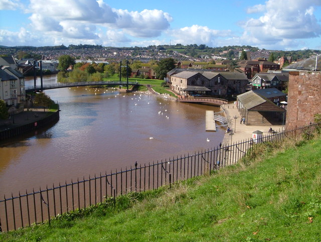
There was almost certainly some sort of quay here in Roman times, but its present form largely dates from the late 1500s. It was much improved in the 1830s, when the imposing warehouses were built. At one end is the old Custom House, dating from 1681 and said to be the first brick building in Exeter. Nearby is the shed of the old fish market which was erected in the late 19th century.
The footbridge crosses one of the leats which was used as power for the industrial premises which were found nearby in medieval and later times. Next to the footbridge are former wine warehouses of the 1870s and 1890s.
Cricklepit Bridge, was built in 1988 to link the Quay with the old canal basin.
A little way along the path passes
There is a record of Malt House pub as the “new brewery” in 1792. It was used as a malthouse from approximately 1890 until 1952.
Gervase Avenue derives its name from Nicholas and Walter Gervase, father and son of the late 1100s and early 1200s and who were behind the building of the first, medieval, Exe Bridge around 1200. Although demolished in 1778 part of it remains, together with its associated St. Edmunds Chapel. The tower of the chapel can be seen over to the right between the two modern bridges. The current bridges were completed in 1978.
The footbridge over to the right, with its distinctive mill-wheel, is the Miller’s Bridge. Dating from 2002, it forms part of the Exeter Green Circle and is also part of Exeter’s cycle network. It links to the Mill on the Exe pub, seen through the trees. This is named as Bonhay Mills in a 1587 map of Exeter.
The main railway line to Torquay, Plymouth and Cornwall, part of Brunel’s great venture, can be seen along the walk.
Exwick Cemetery was established in 1877 as the burial ground for the western side of the city when St. Thomas churchyard was no longer able to cope.
The settlement of Exwick has a long history, with records dating back to the Domesday Book, and it included the hamlet of Foxhayes, giving its name to the road. However, Exwick has expanded greatly over the last 20-30 years so it is now an extensive suburb. There are buses to the city centre from Exwick Road.
At Little John’s Cross – there are buses back to the city centre. It was once an important junction. Barley Lane is on the line of a prehistoric ridgeway and the main road between Exeter and Dartmoor and later, until 1970, was used as the main road to Cornwall. The granite cross can be seen on the opposite side of the road, next to the shop and part at least dates to the 15th century. The name derives from the local family the Littlejohns who owned land here in the 1400s.
The lane becomes a track following a ridge, again on the line of a prehistoric trackway, the continuation of the Barley Lane trackway. The noise of the traffic is from the A30, the modern road to Okehampton and Cornwall which follows the valley. When it was built in 1974 there was much controversy over its siting through what was a quiet and unspoiled area. Through a gap in the trees can be seen the village of Ide.
Ball’s Farm, gets its name from its owners John and William Bolle, recorded in 1228.
Ide Lane, once the main link between the neighbouring villages of Ide and Alphington. It retains some attractive old cottages, mostly from the 19th century.
Alphington is another potential bus cut-out point. This historic village was only absorbed into Exeter in the 20th century, and retains many pockets of semi-rural charm. Until the 1970s it was on the main road to Plymouth.
Clapperbrook Lane was Alphington’s access to the Exe and its marshes and some of this old character remains.
The Alphin Brook, is the stream which cuts the attractive valley at Ide. The old Clapperbrook Lane would have led to a clapper bridge – one of stone slabs – over the Alphin Brook.
The Exeter Green Circle now crosses the bridge to continue its circling of Exeter on the eastern side. This walk leaves the Green Circle here to follow the Exe Valley Way back to the Quay.
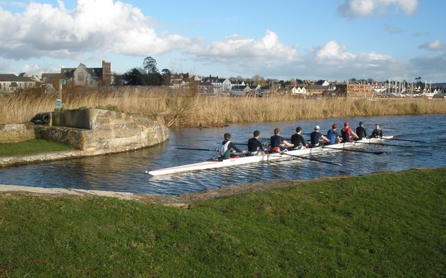
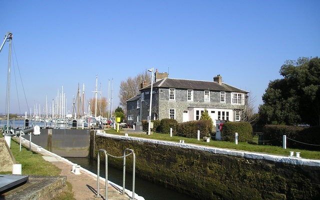
Exeter Canal was built in the 1560s, one of the earliest in England and the first to use pound locks. Built under the supervision of John Trew, it was an attempt to maintain Exeter’s maritime trade after the building of weirs across the Exe by the Courtenay family at Countess Wear in the medieval period. The canal was widened and improved in the 1830s. The canal basin and its warehouses date from the 1830s when the canal was considerably improved and Exeter Quay also rebuilt.
